


In Fairfax County, Virginia, the success of a construction project begins well before the excavation equipment arrives. Whether the work involves a custom home, an addition, a commercial redevelopment, or an infill property, early planning for site development in Fairfax County, VA can help reveal constraints while there is still time to adjust the project.
Lots across the county can vary dramatically in shape, grade, tree cover, drainage patterns, utility access, and development history. A parcel that appears large enough for a proposed building may still require design changes due to setbacks, easements, stormwater requirements, road access, or environmentally sensitive features.
Why Site Readiness Matters
Site readiness means understanding what the land can support, what local rules allow, and what improvements may be needed before final design begins. It is more than placing a building footprint on an aerial map. A preliminary review should consider access, grading, drainage, utilities, zoning, trees, and the relationship between the proposal and neighboring properties.
For example, a lot may have adequate area for a new home but lack a practical driveway location, contain a steep rear slope, or direct runoff toward nearby homes. Finding those conditions early can support a more realistic budget and layout before detailed plans are prepared.
Start With a Property Review
Begin with the basic physical and legal characteristics of the parcel. Property records and a current survey provide an important starting point, but they should be paired with an on-site review whenever possible.
- Confirm the parcel’s size, shape, road frontage, and apparent access points.
- Review recorded easements, rights-of-way, covenants, and utility corridors.
- Determine whether public water and sewer are available or whether well and septic systems may be required.
- Identify steep slopes, wooded areas, streams, flood-prone areas, retaining walls, and visible drainage paths.
- Consider nearby construction or planned development that could affect traffic, utilities, or drainage conditions.
These first questions help distinguish a property that is merely vacant or underused from one that is genuinely positioned for the intended project.
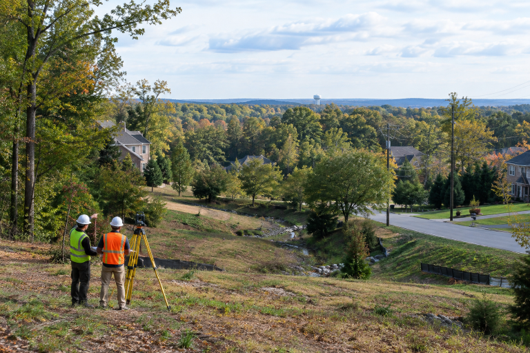
Check Zoning and Land Use
Zoning, long-range planning, and site approvals serve different purposes. Zoning establishes rules for permitted uses and development standards. The Comprehensive Plan provides policy guidance for future growth. A site-specific approval may still be required when a proposal does not comply with the applicable by-right rules.
Before committing to a layout, confirm the permitted uses, setbacks, building height, parking, buffers, lot coverage, and frontage requirements. Current records matter because old listings, prior owner notes, and neighboring projects may not reflect the standards that apply to a particular parcel.
Can a Property Be Buildable but Still Unsuitable for the Planned Use?
Yes. A parcel may support some form of development, but not the exact use, scale, access arrangement, or building placement an owner has in mind. A smaller footprint, different driveway design, added stormwater infrastructure, or a separate land-use approval may be necessary.
Review Existing Site Conditions
A dependable site concept starts with conditions verified in the field and in available records. Online maps are useful for orientation, but they cannot replace a current survey or professional review of the property.
- Confirm property boundaries and visible corner markers.
- Locate existing structures, driveways, walls, and paved areas.
- Review topography, low areas, and existing drainage routes.
- Identify mature trees, streams, wetlands, floodplain areas, and other sensitive features.
- Locate utility lines, poles, meters, pipes, and public infrastructure.
- Look for fill, erosion, settlement, unstable slopes, and signs of past drainage work.
Plan for Stormwater and Erosion
Roofs, patios, driveways, parking areas, and other hard surfaces change how rainwater moves across a property. Grading and stormwater planning should therefore begin with the initial layout, not after the building design is substantially complete. Early coordination can help preserve workable drainage routes and space for required facilities.
Virginia’s stormwater management program addresses the water-quality and runoff impacts associated with land development. In practical terms, project teams should consider where runoff will go during and after construction, how soil will remain protected, and whether proposed changes could affect roads, adjacent lots, or building foundations.
Prepare the Right Documents
The exact submission package depends on the project type, location, scope, and amount of land disturbance. Common materials may include:
- A boundary survey or existing-conditions survey
- A concept plan or preliminary site layout
- Grading, drainage, and stormwater information
- Erosion and sediment control materials
- Utility, access, and frontage details
- Tree, landscape, conservation, or environmental documentation
- Parking, circulation, and traffic-related information when applicable
- Supporting zoning, entitlement, or prior-approval records
Understand 2026 Process Updates
County procedures and forms can change, so applicants should verify current requirements before submitting. Fairfax County Land Development Services revised several site development cover sheets in 2026, with the updated versions required for certain first submissions beginning June 1, 2026. The county also launched its Development Tracker in September 2026, giving residents a way to view active construction, permits, zoning applications, and other nearby development activity.
Avoid Common Delays
Many scheduling problems can be reduced through early coordination. Frequent causes of avoidable delay include using outdated forms, designing before zoning limits are verified, overlooking easements, underestimating grading work, and submitting incomplete plans.
- Confirm utility coordination and access requirements early.
- Account for tree, floodplain, drainage, and conservation issues before finalizing a footprint.
- Use the checklist associated with the specific application or plan type.
- Keep the scope stable during review whenever possible.
- Do not assume a neighboring project followed the same approval path or standards.
Use a Pre-Submission Checklist
- ☐ The intended use has been confirmed.
- ☐ Current zoning information has been reviewed.
- ☐ Property boundaries and easements are known.
- ☐ Existing grades and drainage patterns are documented.
- ☐ Utility availability and access points have been checked.
- ☐ Stormwater and erosion concerns have been identified.
- ☐ Tree and environmental conditions have been reviewed.
- ☐ Current county forms and submission checklists are being used.
- ☐ The project team understands the likely review path.
- ☐ The budget includes permitting, site work, and possible revisions.
Final Takeaway
In Fairfax County, a strong project begins with a clear understanding of the land, applicable requirements, available infrastructure, and review path. A careful site-readiness review cannot eliminate every challenge, but it can help owners and project teams make better decisions before design, permitting, and construction costs increase.

